 EN
EN 中文
中文 ES
ES RU
RU FR
FR PT
PT AR
AR DE
DEStockpile Scanner Placement and Occlusion: An Engineering Guide
Getting stockpile scanner placement right is the single biggest factor in how accurate, repeatable, and maintainable a fixed 3D LiDAR inventory deployment turns out to be. A scanner mounted in the wrong spot will report volumes that drift with the seasons, lose coverage every time a loader parks in the wrong place, and force constant manual reconciliation. A scanner mounted correctly, with occlusion understood and designed around, can hold volumetric accuracy in the low single-digit percentage range over years of operation. This guide walks through how to choose between single and multiple scanners, where to mount them, how field of view and blind zones constrain coverage, how occlusion from moving machinery and the pile itself degrades results, how to tile multiple scanners into one surface, and what to check during an on-site review.
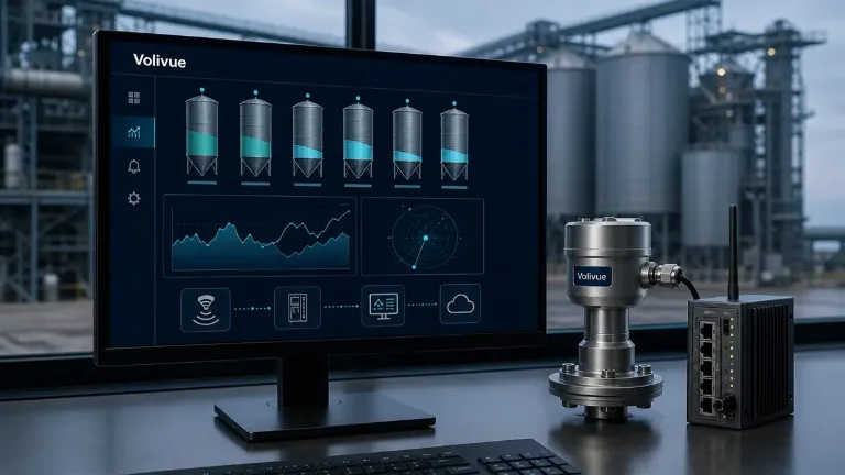
The system referenced throughout is the Volivue 3D LiDAR Stockpile Inventory System, a fixed 3D laser scanner. Typical measurement range is roughly 0.5 to 100 m depending on model, dust loading, and target reflectivity, and calibrated volumetric accuracy is typically in the 1 to 3 percent band. The principles below, however, are general to any fixed-scanner stockpile deployment.
Single Scanner or Multiple Scanners
The first decision is how many scanners a site actually needs, and it is driven by geometry, not by budget alone.
A single scanner suits compact, well-bounded piles where one vantage point can see the full surface without large self-shadowed regions. Small covered bays, single bunkers, and modest open piles with a clear overhead mounting position are common single-scanner cases. The advantage is simplicity: one device, one calibration, one data stream, and no surface-stitching to manage.
Multiple scanners become necessary when a single field of view cannot reach the whole material surface. Long shed-stored piles, wide outdoor stockyards, ring stores, and any geometry where the pile is taller or longer than one scanner can cover from a practical mounting height will need two or more units. A common pattern is to position scanners at opposing ends or corners so that the region each one cannot see is covered by another. The system supports up to 32 measurement zones, which lets a single logical inventory span several physical scanners and several discrete piles within one site.
The decision rule is straightforward: if any operationally important part of the surface would sit in a permanent blind zone or behind the pile’s own crest, plan for an additional scanner rather than accepting a guessed-at volume in that region.
Mounting Positions: Shed, Gantry, and Open Yard
Where the scanner is physically fixed determines its sightlines for the life of the installation, so mounting deserves careful thought. The system can be installed on rooftops, gantries, masts, or walls, and each option must pass a field-of-view and occlusion review before it is committed.
Covered sheds and bays usually offer the cleanest option: a roof-ridge or rafter mount looks more or less straight down onto the pile, minimizing self-occlusion and keeping the scanner clear of moving machinery. The constraints are structural attachment points, rafter spacing, and clearance from material handling equipment such as overhead conveyors or stacker booms.
Gantries and portal structures are the workhorse mount for open and semi-covered yards. A scanner on a gantry beam gets useful elevation and an angle that can reach across a wide pile, but the gantry itself, and any equipment travelling along it, can intermittently block the beam. The review must account for the gantry’s own structure casting fixed shadows.
Masts and poles serve open stockyards where no overhead structure exists. Height is the key lever here: a taller mast reduces the grazing angle at the far edge of the pile and shrinks self-occlusion, but it increases range to the surface and exposes the unit to more wind and weather. Wall mounts suit pits, bunkers, and against-the-wall piles, though a low wall position can leave a large self-shadowed volume behind the crest. Whatever the position, dust, rain, fog, moving machinery, and blind zones must all be assessed for that specific geometry.
Field of View and Blind Zones
Every fixed scanner has a finite field of view (FOV) and a near limit below which it cannot measure. Both shape what the device can and cannot see.
The FOV defines the angular cone the scanner illuminates. Material that falls outside that cone is simply not measured, so the mounting angle has to be set so the full working surface — including the seasonal high-fill and low-draw extremes — stays inside the FOV. Designing only for the average fill level is a frequent mistake: when the pile is unusually high it can rise out of the cone, and when it is drawn down low the far floor can fall outside it.
Blind zones come from two sources. The first is the near limit: with a typical minimum range around 0.5 m, anything closer than that to the scanner is not measured, which matters when a pile peaks directly beneath the unit. The second is geometric shadowing, where part of the surface sits behind something the beam cannot pass through — a structural column, the gantry, or the pile’s own ridge. Blind zones do not announce themselves in the volume number; they quietly bias it, because the system has to interpolate across unseen regions. The goal of placement is to push any unavoidable blind zone onto a part of the surface that rarely holds material, such as a corner that is never filled.
Occlusion from Machinery and Self-Shadowing
Occlusion is the dominant source of real-world error once a system is live, and it comes in two forms.
Dynamic occlusion is caused by moving machinery: loaders, trucks, stackers, reclaimers, and conveyors that pass between the scanner and the pile. While an object blocks the beam, the surface behind it cannot be measured. A well-configured deployment handles this by rejecting frames or regions affected by transient obstructions and by relying on the fact that material does not move while a loader is passing — the last clean view of that region remains valid for a short window. Placement helps too: mounting the scanner so the busiest traffic lanes are not directly between it and the critical pile surface reduces how often dynamic occlusion bites.
Self-occlusion is caused by the pile’s own shape. A tall, steep pile shadows its own far side from any single scanner, especially one mounted low or at a shallow angle. The steeper the repose angle and the lower the scanner, the larger the self-shadowed volume, and the system must estimate that hidden region. This is precisely where a second scanner viewing from the opposite side pays for itself: what one unit cannot see behind the crest, the other sees directly. Where a second scanner is not justified, raising the mount and steepening the look-down angle is the next best lever for shrinking self-occlusion.
Both forms of occlusion degrade coverage first and accuracy second. A surface that is only ever partially observed forces interpolation, and interpolation across a large hidden region is where the 1 to 3 percent accuracy band starts to widen. Quantifying expected occlusion is part of the placement review, not an afterthought.
Tiling Multiple Scanners into One Surface
When a site uses several scanners, their individual point clouds have to be combined into one continuous surface before a volume can be computed. This stitching, or tiling, is what turns separate viewpoints into a single inventory.
The foundation is a shared coordinate frame. Each scanner is registered into a common site reference during commissioning so that a point measured by one unit lines up with the same physical location seen by another. Overlap between adjacent fields of view is deliberate: the shared band gives the registration something to lock onto and provides redundancy so that if one scanner’s view of a region is temporarily occluded, a neighbour still covers it.
Good tiling depends on good placement. Scanners should be positioned so their coverage areas overlap rather than leaving an unobserved seam between them, and so that no single tile carries a disproportionate share of self-occluded surface. When tiling is done well, the operator sees one volume figure and never has to think about the underlying geometry; when it is done poorly, seams and gaps show up as step changes and drift in the reported total.
On-Site Review Checklist
Before any mounting is finalized, walk the site against a consistent set of checks. This review is what separates a placement that holds accuracy from one that needs constant correction.
- Surface coverage across fill extremes. Confirm the full working surface stays inside the FOV at both maximum fill and full draw-down, not just at average level.
- Blind-zone mapping. Identify near-limit and geometric blind zones for the proposed position and verify they fall on rarely filled regions.
- Self-occlusion estimate. For the expected pile shape and repose angle, estimate the self-shadowed volume from each candidate position and decide whether a second scanner is warranted.
- Traffic-lane interference. Map loader, truck, and stacker paths and keep heavy traffic out of the direct line between scanner and critical surface where possible.
- Environmental loading. Assess dust, rain, fog, and reflectivity for the material and site; these affect effective range and may shift the practical accuracy within the typical band.
- Mounting integrity. Confirm structural attachment, clearance from moving equipment, and access for cleaning and maintenance.
- Multi-scanner overlap. For tiled installations, verify adjacent fields of view overlap and that a common reference frame can be established.
Documenting the outcome of each check gives the commissioning team a baseline to validate against and a record to revisit if accuracy ever drifts.
Placement is an engineering decision, not a mounting convenience. Get the geometry, field of view, blind zones, and occlusion modelled up front, and a fixed 3D LiDAR deployment will deliver dependable volumes with minimal intervention. If you want a placement and occlusion review for your specific stockyard geometry, request a site assessment from our engineering team. For deeper material on related topics, the 80 GHz silo radar level platform covers enclosed-vessel measurement where stockpile scanning does not apply.
Related reading
Continue with more field-engineering articles in our Technical Insights library.