 EN
EN 中文
中文 ES
ES RU
RU FR
FR PT
PT AR
AR DE
DECoal Stockpile Inventory at Power Plants: Continuous 3D LiDAR Volume Measurement
For a coal-fired power plant, the fuel sitting in the yard is one of the largest working-capital items on the balance sheet, yet it is often the least precisely measured. Accurate coal stockpile inventory is what ties the weighbridge at the gate to the burners in the boiler house, and getting it wrong distorts everything from fuel procurement to month-end financial close. Open coal piles are large, irregular, dust-laden, and constantly reshaped by stackers, reclaimers, and dozers, which makes them genuinely difficult to survey. This article looks at why manual stockpile measurement struggles at power plants and how fixed 3D LiDAR scanning provides a continuous, repeatable volume baseline that integrates with fuel management and ERP systems.
Why coal pile measurement is hard at power plants
A utility coal yard is not a tidy warehouse. The pile can run tens of meters high and hundreds of meters long, with multiple grades or supply contracts stored in separate zones. The surface is never flat: every shift, equipment carves out reclaim faces and dumps fresh deliveries, so the geometry changes daily.
Traditional measurement methods all carry compromises. Drive-by visual estimates are fast but wildly imprecise. Walking the pile with a GPS rover or running a periodic drone survey gives a snapshot, but it requires people or aircraft over an active, moving stockpile, and it only happens monthly or quarterly. Between surveys, the plant runs on a “book” inventory derived from belt-scale readings in minus belt-scale readings out — a calculation that accumulates error with every tonne handled.
The consequences are concrete. A coal yard reconciliation that drifts by even a few percent on a large pile represents thousands of tonnes of unexplained variance. That gap forces conservative fuel ordering, complicates contract settlements with suppliers, and can mask losses from spontaneous combustion, moisture change, or handling. The yard team often cannot say with confidence how many days of burn are actually on site.
Safety adds another layer. Sending surveyors onto a steep, settling coal pile near operating reclaimers exposes people to fall, engulfment, and dust hazards. Anything that keeps staff off the pile while still producing a number is operationally valuable.
How 3D LiDAR delivers continuous coal stockpile inventory
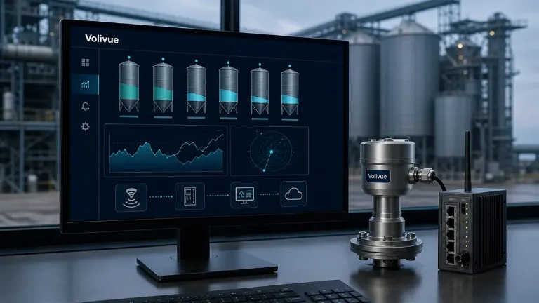
Fixed 3D laser scanning takes a different approach: instead of sending people to the pile, the measurement instrument watches the pile. The Volivue 3D LiDAR Stockpile Inventory System uses fixed laser scanners that sweep the stockpile surface and build a dense point cloud of its geometry. Software fits that surface against a known base plane or reference floor and computes the enclosed volume, which is then converted to mass using a configured bulk density for the coal grade.
Because the scanners are fixed infrastructure rather than a one-off survey, the measurement can repeat on a schedule — hourly, per shift, or on demand — without anyone entering the yard. Effective scan range is typically on the order of 0.5 to 100 m depending on the model and mounting geometry, which lets a single installation or a small cluster of units cover a working pile from gantry, mast, or building-edge mounts.
Multi-zone support matters in a power plant context. A yard storing several coal sources can be partitioned into defined regions, so the system reports volume and tonnage per zone rather than one aggregate figure. That maps directly onto how procurement and combustion teams already think about their fuel: by contract, by calorific grade, by blend.
On volume accuracy, fixed 3D LiDAR is typically in the range of 1–3% after calibration, with the exact figure being model- and site-dependent. The number that ultimately matters to the plant is tonnage, and that depends on the density assumption as well as the geometry — coal bulk density shifts with grade, moisture, and compaction, so density handling should be configured and reviewed rather than treated as a fixed constant.
A realistic caveat belongs here: coal yards are dusty by nature, and heavy airborne dust, rain, or fog can degrade individual scans. Sites with aggressive dust generation or persistent precipitation should treat environmental conditions as part of the engineering review, including scanner placement, scan timing, and how the system handles temporarily obstructed returns.
Integrating LiDAR inventory with ERP and fuel management
A volume number is only useful when it reaches the systems that act on it. The system is built to feed data outward rather than sit in a standalone display. It exposes results through OPC UA, REST API, MQTT, CSV export, and direct database export, which covers the common integration paths in a power plant environment.
OPC UA and MQTT connect cleanly to plant control and historian layers, letting current stockpile tonnage live alongside boiler and belt-scale data. A REST API or scheduled CSV and database exports suit the business systems: pushing measured inventory into the fuel management application or the ERP module that handles fuel accounting and procurement. That closes the loop that the introduction described — measured pile tonnage can now be reconciled against the running book figure derived from belt scales, and against delivery and consumption records.
The reconciliation use case is the core value. When a surveyed (LiDAR) tonnage and a calculated (belt-scale) tonnage diverge, the gap becomes visible early instead of surfacing as a surprise at month-end. Persistent divergence points to belt-scale calibration drift, density assumptions that no longer match the delivered coal, or real physical loss. Either way, the plant is troubleshooting a quantified discrepancy rather than arguing over estimates.
For procurement and operations planning, a trustworthy days-of-burn figure improves decisions. Knowing the actual tonnage on hand per grade supports tighter fuel ordering, better blend planning, and more defensible contract settlements, while reducing the need to over-buy as a hedge against measurement uncertainty.
Operational and safety value at the power plant
Beyond the inventory number, continuous scanning changes how the yard runs day to day.
The most direct benefit is keeping people off the pile. Routine inventory no longer requires a surveyor to climb a settling stockpile near operating reclaimers, removing a recurring exposure to fall, engulfment, and respirable-dust hazards from the routine measurement workflow.
Continuous geometry also gives the operations team better situational awareness. Because the system captures the pile surface repeatedly, the team can see how the stockpile shape evolves between deliveries and reclaim cycles, which supports more even pile management and helps housekeeping discipline in the yard.
Finally, a frequent and consistent data trail supports the kind of variance investigation that an occasional manual survey cannot. A monthly survey can tell you something is off; a recurring measurement that runs every shift can show when the divergence began, which narrows the search for a cause considerably.
A practical path to deployment
Moving to LiDAR-based coal stockpile inventory is an engineering exercise, not a plug-in purchase, and treating it that way protects the result. The work starts with the yard itself: pile dimensions, the number of grades or zones to report separately, available mounting points, and the local dust and weather regime. Those inputs drive scanner count, placement, and the integration design.
Density handling deserves explicit attention up front. Because tonnage depends on the bulk density applied to the measured volume, the project should define how density is configured per grade and how it is reviewed as coal sources change, so the reported mass stays trustworthy over time.
Integration scope is the other early decision. Confirm which downstream systems consume the data — historian, fuel management, ERP — and which transport (OPC UA, REST, MQTT, CSV, or database export) each one expects, so the inventory figure lands where it is needed without manual re-keying.
If you are evaluating continuous stockpile measurement for a coal yard, the most useful next step is a site-specific review of your pile geometry, zones, environmental conditions, and integration targets. Request an application review for your coal yard and we will assess fit, expected accuracy for your conditions, and the right scanner configuration.
—
Related reading: explore more measurement and inventory engineering articles in our technical insights library.